A helicopter will be making the rounds on the north side of the Harbour Bridge in the new year surveying for kauri dieback disease.
The aerial surveillance is to finish off the northern survey started earlier in 2018, and cover any spots that still need to be surveyed, looking for ill health in the kauri canopy.
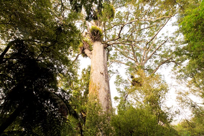
“Photographs are taken of any unhealthy kauri canopy from the air, and these spots are mapped using GPS and investigated on the ground, with soil samples taken where needed,” says Lisa Tolich, Biosecurity Manager-Kauri Dieback at Auckland Council.
“If any spots are on private land, the landowners will be notified and asked for permission to take soil samples on their land.
“Kauri dieback disease is present in Kauri Park in Birkenhead and Department of Conservation reserves in Albany, Okura and Pakiri. However, it has not been detected in our northern regional parks or any other kauri forest in Kaipātiki.
"Finishing off this survey will give us a complete picture of the northern part of Auckland, and further inform our disease management in this area.
“The helicopter carrying out the survey is likely to be seen tightly circling over areas of forest.
“The northern survey is part of Auckland Council’s kauri dieback active surveillance programme, in which each area of Auckland is surveyed on a five-yearly cycle for disease. In 2019, aerial surveillance is also due to occur south of the bridge including the areas bordering the Waitakere Ranges, the Hunua lowlands and Hauraki Gulf Islands,” says Lisa.
For more information on Auckland Council’s kauri dieback management programme, visit aucklandcouncil.govt.nz/protectkauri and for general information on kauri dieback disease, visit kauridieback.nz.
