Auckland Council has carried out an aerial survey of Auckland’s northern regions to identify areas that may be affected by kauri dieback disease.
A helicopter and a plane were used to survey regional parks throughout Rodney and the North Shore.
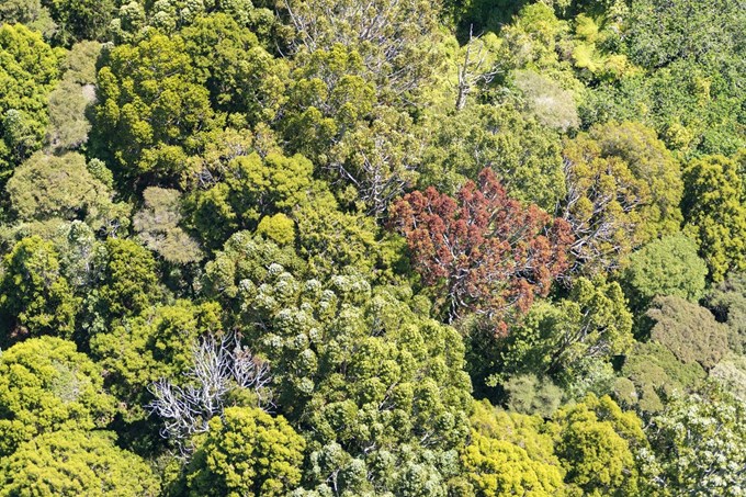
Areas with unhealthy kauri canopy were photographed and their locations mapped using GPS so they could be investigated further by teams on the ground.
Soil samples from potentially infected areas will be taken to check for the presence of kauri dieback disease.

Landowners will be notified and asked for permission if soil samples need to be taken from areas on private land.
Council hopeful that northern regions are not infected
Lee Hill, an Auckland Council senior biosecurity advisor, says he is hopeful test results will not show any evidence of kauri dieback.
“Kauri dieback disease is present in Department of Conservation reserves in Albany, Ōkura and Pākiri,” he says.
“However, in the past it has not been detected in our northern regional parks or in kauri forest in Kaipātiki. We hope this survey shows the same healthy result.”
This survey is part of a region-wide kauri dieback monitoring programme Auckland Council has run since 2010 and is funded by the national kauri dieback management programme.
It follows repeat surveys of the Waitākere Ranges and Hunua Ranges and single surveys of Hauraki Gulf islands, the Awhitū Peninsula and northern regional parks.
How you can help stop kauri dieback disease
For more information on kauri dieback disease, including what you can do to help, visit kauridieback.co.nz or follow the national kauri dieback management programme on Facebook.

