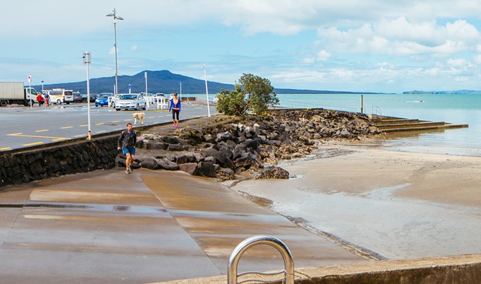
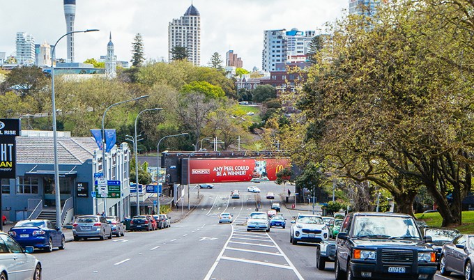
Images from Auckland Libraries' heritage collections, juxtaposed with recent photographs, show Auckland's transformation throughout history.
View more historical images at OurAuckland.
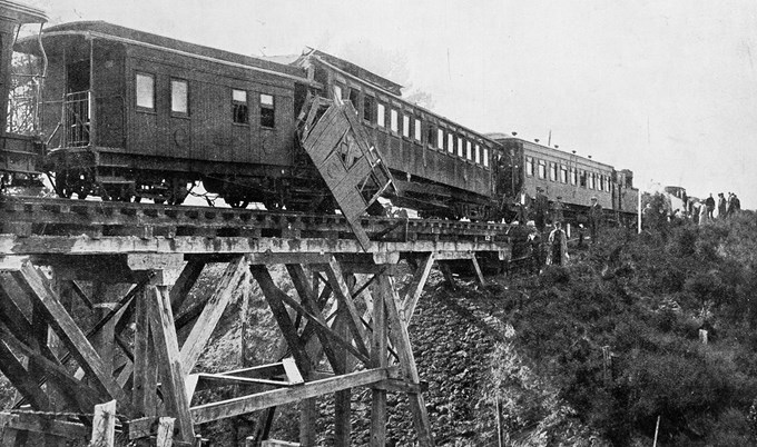
The scene of a serious railway accident on the Auckland suburban line in May 1913. An outward- and an inward-bound train collided in New Lynn on the Kaipara line. This image shows the telescoped cars which remained on the bridge, 50ft above the creek.
The collision occurred during heavy fog on the morning of May 28 1913.
Excerpt from The Auckland Weekly News, 5 June edition:
"A passenger train of eight coaches, from Henderson to the city, carrying about 80 passengers, and running fast into the station, crashed with great violence into a goods train on the line close to the bridge to the north of the station. The second and third carriages were telescoped, and of the two passengers in one of them, one escaped without injury, and the other, Mr. E.H. Stone, of Waikumete, was seriously injured. Many other passengers were injured, eight of them sustaining severe cuts and contusions. The accident occurred on a bridge 50ft above a small stream, but fortunately, through the cars jumped the rails, they remained on the bridge."
Photo: Sir George Grey Special Collections, Auckland Libraries
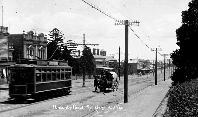
This heritage image taken around 1908 shows a tram and horse-drawn carts on Ponsonby Road heading away from the intersection of Karangahape Road, Newton Road, and Great North Road with the Salvation Army Hall to the left.
Photo: Sir George Grey Special Collections, Auckland Libraries
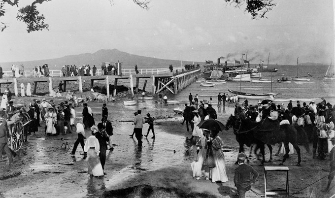
Taken in 1897, this classic image looks northeast from Takapuna Beach at the foot of The Promenade towards Rangitoto Island. It shows a group of holidaymakers on the beach, and strolling along the wharf, with a paddle steamer ferry and other pleasure craft moored nearby.
Photo: Sir George Grey Special Collections, Auckland Libraries
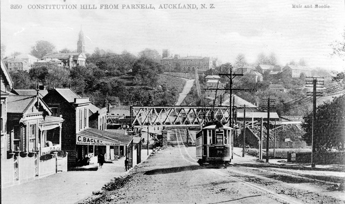
This image, taken around 1910, shows the Strand looking west from Gittos Street (later named Parnell Rise, foreground) showing Parnell Railway Bridge in the course of replacement, Constitution Hill and the Supreme Court, (centre background), St Andrews Presbyterian Church, (left background), the premises of Charles Bagley, fruiterer, (left foreground), and a tram bound for Remuera.
Photo: Sir George Grey Special Collections, Auckland Libraries
