Auckland Council will be asking people who live, work, visit and care for Piha what options they think best manage the flood safety risk in the area.
Environment and Community Committee Chair Councillor Penny Hulse says the council will consider a long list of options that mitigate the safety risk from floods in and around Glenesk Valley in Piha.
“Council staff have put together a comprehensive list of options that could be put in place in Piha to offer protection to people that live in the valley, in the community, or are visitors to the area.
“These options range from significant engineering, or hard infrastructure, options to increased community-focussed work on early warning and emergency response options.
“We are very aware of the balance that needs to be applied to any decision-making on this matter. Piha is not the only community that has people living, working or recreating in flood prone areas.
“Whatever we do in Piha may influence flood risk management elsewhere in our region. This includes us being clear on where ratepayer funds are spent and what planning and regulatory tools, or improvements to those tools, are required.
“We hope that everyone with a connection to this issue in Piha takes the opportunity to read the report, look at the potential options and provide us with their feedback – and if there’s anything we haven’t thought of or you think we should be considering, let us know,” says Cr Hulse.
The committee agreed to work with the Waitākere Ranges Local Board, Piha community and landowners as well as Te Kawerau ā Maki and Ngāti Whātua on a long-list of options in response to a high flood safety risk in Piha.
A report will come back to the committee in June 2019, with a summary of the engagement findings and decision on the next steps.
About the options
These options seek to keep people away from floods, enhance readiness and responses to flooding, or keep floods away from people. The scope of the options do not impinge on private property rights or responsibilities.
Taking this approach will ensure that any future decision-making takes into consideration the views and preferences of all affected or interested parties.
Long list of options
|
Current situation to keep people away from flooding |
Option 1: Local responses to minimise the impact of storm events (status quo) |
|
Enhancing readiness and response to flooding |
Option 2: Increase flood warning time Option 3: Enhance ways of warning people Option 4: Raise Glenesk Road |
|
Physical protection works to help keep flooding away from people |
Option 5: Build a dam(s) to contain flood water Option 6: Build a tunnel to divert flood water Option 7: Widen the stream to increase water flows Option 8: Clear/dredge the stream from Seaview Road Bridge to the sea to increase water flows. |
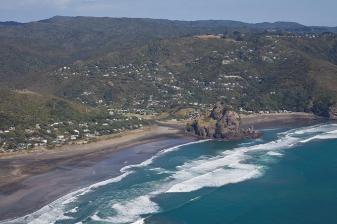
Flood risk at Piha Glenesk
Extreme rainfall events on 3 February and 28 April 2018 led to significant flooding at Piha. On both occasions high water depths and velocities resulted in emergency evacuations and flooding at residential properties on Glenesk Road, Piha Campground and Piha Mill Camp. Access along Glenesk Road was also cut-off as water depths and velocities made it unsafe for wading or vehicles.
After these events Auckland Council undertook flood modelling and commissioned Tonkin & Taylor to produce an independent assessment. These analyses concluded that the Piha Stream is subject to flash flooding, and that unsafe flooding may occur frequently.
The analysis also noted that Glenesk Road is likely to flood on an annual basis. Overtopping of some access bridges can be expected every other year. Flooding of approximately 10 buildings is likely in a five-year rainfall event, increasing to approximately 21 buildings in a 100-year event.
