The road to recovery continues for many in Tāmaki Makaurau, including our west coast communities.
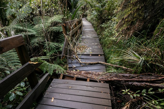
The Auckland Anniversary weekend floods and Cyclone Gabrielle resulted in damage in some areas of our regional parks, including many popular walking tracks.
Taryn Crewe, Auckland Council General Manager, Parks and Community Facilities, understands how well-loved these tracks are and reassures Aucklanders that we are working to re-open those affected as soon as we can.
“Preliminary assessment shows that, except for slips, many of the recently upgraded tracks held up well despite the unprecedented weather. However, some tracks remain closed due to slips, damaged structures, or dangerous trees,” says Taryn Crewe.
“Our park rangers and staff are continuing to assess damage and accessibility, with a view to opening more areas as soon as possible while considering the impact on locals.”
The forested area within the Waitākere Ranges remains subject to a rāhui by Te Kawerau ā Maki and our staff are working closely with Te Kawerau ā Maki to audit relevant tracks to ensure these can reopen safely.
Some of the tracks connecting to the Waitākere Ranges Regional Park network, like the Te Henga Walkway, are on public conservation land and are managed by the Department of Conservation (DOC), meaning decisions around their status sits with DOC. This track is currently open.
We ask the public to respect all closures and not remove any barriers or signage currently in place for their own safety, and to not add to environmental damage in the area, including the threat of spreading kauri dieback disease.
As work continues on reopening all affected tracks, we encourage visitors to check our map of open and closed tracks on the Auckland Council website before heading out. The map details the most up-to-date information on tracks and regional parks.
