Since the launch of the Safeswim programme last November there have been a lot of questions about what it is and why we’ve done it. Here are answers to the most common questions.
Is Safeswim just about water quality?
No, the new Safeswim programme also provides information about the risks generally present at a specific beach and alerts for current hazards such as dangerous wind and wave conditions, strong currents and marine animals - in particular jellyfish and sharks.
Who updates Safeswim?
Safeswim's water quality forecasts revise automatically in response to changing conditions and are updated every 15 minutes in response to observed rainfall (measured by rain gauges around the region). Sensors on the wastewater network detect sewage overflows and automatically trip alerts on the system.
The ‘hazard’ alerts are uploaded by Healthy Waters employees following advice from Safeswim technical staff, Pollution Control, Watercare, Auckland Regional Public Health Service and the Surf Life Saving Command Centre, who get updates from their patrol captains about current conditions.
It’s important to remember there’s no such thing as a completely safe beach. What Safeswim does is give advice on the levels of risk associated with a beach or waterway so you can make informed decisions about where and when to swim.
Why aren’t there signs on every beach?
It would be impractical to install signs on every beach experiencing water quality issues. Research from similar programmes internationally showed that beach users often pay little attention to warning signs once they have invested the time and effort to get to the beach; they will usually swim irrespective of what signs say. That’s why information on water quality and hazards needs to be available before people head to the beach.
We encourage you to visit Safeswim.org.nz before you choose to go to a specific beach, in the same way you would check traffic conditions on Google Maps before setting off on a journey or the weather forecast before planning when to have a picnic outdoors.
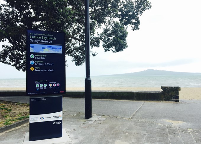
We are trialling digital signs that update automatically at a small number of locations and may roll them out to more beaches should they prove successful.
Is the council closing beaches?
We can’t close beaches, however if conditions are dangerous on our patrolled beaches, our community partners the Northern Region Surf Life Saving lifeguards will drop the flags and advise people against swimming.
Why do we need Safeswim?
We know we have issues with the water quality at our beaches, especially after heavy rainfall, and we have a responsibility to ensure everyone is aware of the risks.
Safeswim gives beachgoers up-to-date, useful information about the area they are planning to visit. By using models, new sampling methods and real time sensors, the new Safeswim programme is up to 20 times more accurate than our previous programme which presented the results of historic samples.
At the end of the day it’s down to each person to make the choice about whether or not to swim. We just want to make sure you have the right information, so you can make the safest decision - and we want to use Safeswim to identify weak spots in the water management system that need to be fixed.


