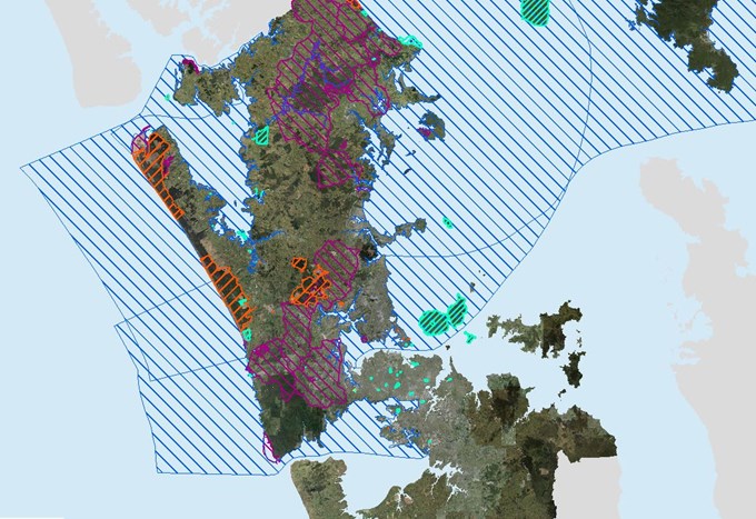
Aucklanders now have the opportunity to learn about the Māori connection to Tāmaki Makaurau as expressed through Treaty settlement processes thanks to a recent development on the Auckland Council GIS viewer Geomaps.
Called the Treaty Settlements layer, it allows users to identify areas that have been acknowledged in treaty settlements as being of significance to Māori.
How does it work?
The layer shows both the Statutory Acknowledgement areas for individual iwi who have gone through the settlement process, and the commercial and cultural redress land.
The latter partially forms the Crown’s apology for the historical breaches of the Treaty of Waitangi. As settlements are finalised and brought into law, the layer will be updated.
This development was made possible thanks to joint initiative by Council’s Plans and Places and Information and Technology departments.
Making information more accessible
The land subject to Treaty settlements used to only be shown on printed maps. The digitalisation of the maps makes it more accessible, offering a view of the Māori cultural landscape for iwi and Aucklanders alike.
Statutory acknowledgements including statements of association for iwi are included in the Unitary Plan. This window into Māori heritage includes information about how local resources were used centuries ago and original place names.
“Returned treaty settlement land is allowing iwi to strengthen their relationships with their ancestral lands," says Siani Walker, Team Leader, Māori Heritage with the Plans and Place department at Auckland Council.
"It’s great to have this important information more easily accessible.”
How to view the ‘Treaty Settlement’ layer
- Go to the Auckland Council website.
- Click GIS map viewer (located to the right of the screen under list of ‘Top content’)
- Open Geomaps
- Select eye shaped icon to ‘Search items in portal’
- Type Tangata in the search box and hit 'Go'
- Click to ‘add’ the result TangataWhenua
- Select Legend tab
- Use the drop-down arrows to select Treaty Settlements
- Zoom in to area of interest
To understand the identification of the Treaty Settlement alert layer and the Statutory Acknowledgements area, click on Legend and then use the drop-down arrow to show what the different hatching identifies.


