
A new project is underway to grow and restore tree canopy, food forests and gardens for a greener future across Māngere.
The Māngere Ngahere Demonstration Project is a Kāinga Ora initiative and aligns with Auckland’s Urban Ngahere Strategy to increase canopy cover to at least 15 per cent in every local board area.
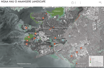
Māngere-Ōtāhuhu Local Board is supportive of the project and provided funding to develop an analysis of tree cover in the area, which spans about 5,200 hectares and is dominated by Te Pane-o-Mataoho (Māngere Mountain), the Manukau Harbour and Tāmaki Estuary.
Chair Tauanu’u Nick Bakulich says, “Given what our community has gone through with the floods and the ongoing changes to the climate this piece of work is very much welcomed by many.”
As part of the Maangere Ngahere Project, Kāinga Ora partnered with mana whenua, ME Family Services and Uru Whakaaro to create the Ngaa Hau o Maangere Ngahere Planting Guide.
The recently launched guide will help contribute to increasing environmental and cultural outcomes for the communities of Māngere — connecting nature, people, and place.
Jenny Chilcott, Ngahere Lead for Kāinga Ora says, “We were so pleased to have been guided by the expertise of both Te Ahiwaru and Te Aakatai in shaping this document.”
“The aim is to understand, restore and enrich ngahere in Ngaa Hau o Māngere, connecting taangata (people), whenua (land), wai (water) and te taiao (environment), and recognising the interconnection of health and wellbeing of all.”
ME Family Services Taiao Team Manager Justine Skilling adds, “It’s so amazing to have such a beautiful book that focuses on the taiao of Maangere. We’re so privileged to be part of this project and see this guide as a way that all of us in Maangere can contribute to the maunga to moana regeneration of our ngahere.”
According to Te Ao Māori values and principles, the guide walks the reader through a decision-making process for choosing the right tree for the right spot.
It aspires to be a readily available tool utilised by everyone engaged in efforts to preserve, revitalise, and regenerate ngahere throughout the many landscapes of Ngaa Hau o Maangere.
Officially launched in June 2023, around 60 representatives from the community and contributing organisations came together for kōrero and kai to celebrate the new guide.
The intention is that the guide will be used alongside Auckland Council, the community and key build and alliance partners to benefit Māngere for years to come.
As part of the larger Māngere Ngahere Demonstration Project, Kāinga Ora is developing frameworks, policies, ways of working and tools for how it can contribute to protecting and enhancing ngahere on all Kāinga Ora properties and the communities it works with.
Ngahere in the Māngere-Otahuhu Local Board Area:
-
About 14 per cent of the local board area is public parkland with significant sports parks, including Māngere Centre, Moyle, Walter Massey, Sturges and Seaside parks.
-
Large passive reserves include Māngere Domain, celebrated green flag holder Ambury Farm Regional Park and Ōtuataua Stonefields Historic Reserve, which contains pockets of remnant rock forest with karaka, pūriri and tītoki.
-
Key biodiversity sites include Ōtuataua, Ambury Farm, Portage Road Reserve, Puketutu Island, and Pūkaki Lagoon.
Stay connected
Want to stay up to date with all the latest news from your area? Sign up for our Māngere-Ōtāhuhu Local Board e-newsletter and get it delivered to your inbox each month.