


In early 2023 communities across Mt Roskill and Wesley (Ōwairaka) were impacted by flooding, with over 350 homes assessed for immediate safety risks, and almost 100 homes that had safety access restrictions. There were also a number of Kāinga Ora homes affected by flooding, increasing the overall number of homes impacted in these communities.
The most affected neighbourhoods were around the Oakley Creek which runs through the War Memorial Park in Wesley, and under Dominion Road toward Mt Roskill Grammar.
Since then, tonnes of debris has been removed and roads, parks and public facilities have been repaired. While most locals have moved on with their lives, the job continues to help affected homeowners and the community recover, while increasing their future storm resilience and preparedness.
On this page:
- Latest recovery update
- Flood resilience projects
- Ongoing stormwater work
- Future risk at homes (categorisation)
- Unit-title and cross-lease situations
- Wellbeing support
- High-risk home removals
- Maintenance of Category 3 sites
- Future and interim use of Category 3 land
- Community recovery and events
- Responsible development
- Flood maps
- Preparing your home and family
Recovery update - 9 March 2026
|
|
Category 3 properties |
Buy-outs settled |
Shared ownership properties |
Houses removed |
|
Mt Roskill |
61 | 51 |
28 |
9 |
|
Wesley (Owairaka) |
21 |
15 |
1 | 4 |
|
Total |
82 | 66 | 29 | 13 |
Major flood resilience projects
Auckland Council currently has nine flood resilience projects, also known as blue-green networks, at various stages of planning and design.
The Te Auaunga/Oakley Creek (Mt Roskill) long-term flood mitigation project is currently unfunded but early design and modelling is underway. To keep up to date on progress and frequently asked questions, check out the latest update on the council’s website.
Ongoing stormwater work
The council has increased stormwater maintenance and monitoring in the area with activities including:
- Monitoring, regular inspections and cleaning of hot spots, including monitoring and clearing ahead of forecast weather events (some have monitoring cameras)
- Increased catchpit clearing (debris traps in drains) from once to twice a year following 2023 storms
- 4 hot spot cameras have been installed locally to help us monitor blockage issues
- Removed tonnes of debris from Oakley Creek – including by helicopter – 124 tonnes on one occasion
- Started upgrading to ‘back-entry’ catchpits (drains) that still take in water if the top grate is blocked.
We are also working with the community to help reduce dumping around streams and increase storm preparedness.
Flood risk at homes
The council has assessed homes affected in the 2023 storms that registered for a future risk category, offering buy-out or construction grant support depending on the level of 'intolerable' risk. Categories in Mt Roskill and Wesley (Ōwairaka) include:
- Category 1: 112 local homes were cleared of having an 'intolerable risk to life' from future flooding and landslides.
- Category 2P: 9 homes in the area were identified as having an 'intolerable risk to life', but are receiving support to implement solutions at their home that will reduce this risk to a reasonable level.
- Category 3 : 81 homes in the area were identified as having an 'intolerable risk to life' but there is no viable solution to reduce the risk to a reasonable level. These homeowners have been offered a buy-out to help them move out of harm's way.
As of 04 November 2025, across the Mt Roskill and Wesley, around 53 buy-outs have been completed, with the rest at various stages of the buy-out process.
For information about storm affected Kāinga Ora properties, email centraleastakl.region@kaingaora.govt.nz.
Unit title and cross-lease situations
We acknowledge how complex and emotional these situations are — particularly for homeowners in shared ownership situations with Category 3 homes on the property. So we recognise the importance of ongoing communication in these situations.
In unit-titles and cross-lease situations we’ll notify other owners on the property after a sale is agreed with council, keep them updated of our plans, and seek written approval where required for any activities. Plans could involve making the site safe, exploring non-residential uses, or other appropriate options.
For more information see our multi-unit and cross-lease FAQs.
Wellbeing support
Various community and wellbeing support is available for storm-affected residents, including free help with processing home insurance claims, rates relief, temporary accommodation assistance, and wider financial and mental health support. Check out the available wellbeing resources on OurAuckland.
The Storm Recovery Navigation Service closed as of December 2025, as many of the whānau affected by the 2023 severe weather events have moved forward in their recovery journey.
Removal of high-risk homes
As part of the area's recovery from the 2023 storms, Auckland Council has moved into its next phase of work — removing larger clusters of high-risk Category 3 homes that were part of the voluntary buy-out programme.
But with 81 Category 3 homes in the area, we know this will bring significant change to the neighbourhood — and we’ll ensure it’s managed with care.
As we confirm detailed plans for each cluster of homes for removal, we’ll inform direct neighbours and previous homeowners, while keeping the wider community updated about the general programme of work.
In unit-titles and cross-lease situations we’ll notify other owners once a sale is agreed, keep them updated of our plans, and seek approval where required for any activities. And we’ll continue to look at how we make Category 3 units within multi-unit complexes safe instead of removing them.
Most homes will be removed or deconstructed, with around a third relocated for use elsewhere. Salvageable materials will be sent to recycling partners for reuse.
Most homes will be removed or deconstructed, with around a third relocated for use elsewhere. Salvageable materials will be sent to recycling partners for reuse. Active work areas will be fenced-off and clearly signposted with contractor information and work dates - so keep an eye out for the signs.
A key challenge is Category 3 homes in shared ownership situations, including cross lease and unit titles, where we need to carefully work with any remaining co-owners. These can be complex depending on a number of factors such as sites with different categories or where not all opted into categorisation – often with shared assets. Alongside this, some buy-outs are not yet finalised. This takes time and we appreciate this can prolong the uncertainty for those remaining.
We thank these homeowners very much for their cooperation.
Read more on the home removal programme. Please contact RecoveryOffice@aucklandcouncil.govt.nz if you require more information.
Maintenance of Category 3 properties
After settlement of a property, Auckland Council provides a basic level of maintenance on a monthly schedule. The focus is on maintaining areas visible from roads and footpaths i.e. berms and front yards on properties that have road frontages.
Until we take ownership, the private property owner is responsible for maintaining the site. You can report an issue with a council-owned property using the ‘Report a Problem’ tool on the council website, under the ‘community venues, parks, beaches and other spaces’ heading.
As expected, empty homes can attract vandalism and break ins (one of the reasons we are trying to manage the sharing of Category 3 addresses). In some situations we are boarding up homes, in others we have cameras or undertake patrols. You can help by reporting anything suspicious or threatening to the police as soon as possible.
Future use of storm-affected land
We have a region-wide policy that guides what we do with this land. Our top priority is always safety — but we also need to make sure we’re delivering good value for Aucklanders, especially given how expensive these buy-outs have been. You can find the policy online at ourauckland.nz/futureuse.
Essential use or hazard management
We're considering how Category 3 land can support essential council services like flood mitigation, which will save Aucklanders money in the long run. We expect around half of the properties to remain with council either because they're useful or need management due to high hazard risks.
Opportunities for sale
But holding onto land has ongoing costs. If a property isn’t needed for essential council services or hazard management, we’ll consider selling it where’s it’s safe to do so.
Some sites may become safe for redevelopment by building on less hazardous areas or having the risk reduced through measures like flood protection upgrades.
If the land isn’t essential or redevelopable, other sale options will be considered, such as backyard extensions for neighbours or rural grazing. Due to the hazard, there will be limitations on use.
Community uses
We’re working with local boards and mana whenua to explore community uses for land where council services or sale aren’t viable. This could include parks or open spaces in areas that lack them – particularly where funding is available to support these initiatives.
Interim uses
In the meantime, we’re considering safe temporary uses with supporting guidelines. Community groups and organisations can apply to use this land for low-risk, non-residential activities like planting, grazing, play equipment, or temporary events. Guidelines are available at ourauckland.nz/futureuse.
Got a land use suggestion?
After looking at the guidelines you can make suggestions for future or interim uses at ourauckland.nz/futureuse. We’ll only get in touch when we have an update – this will take time.
Looking forward: Community recovery planning
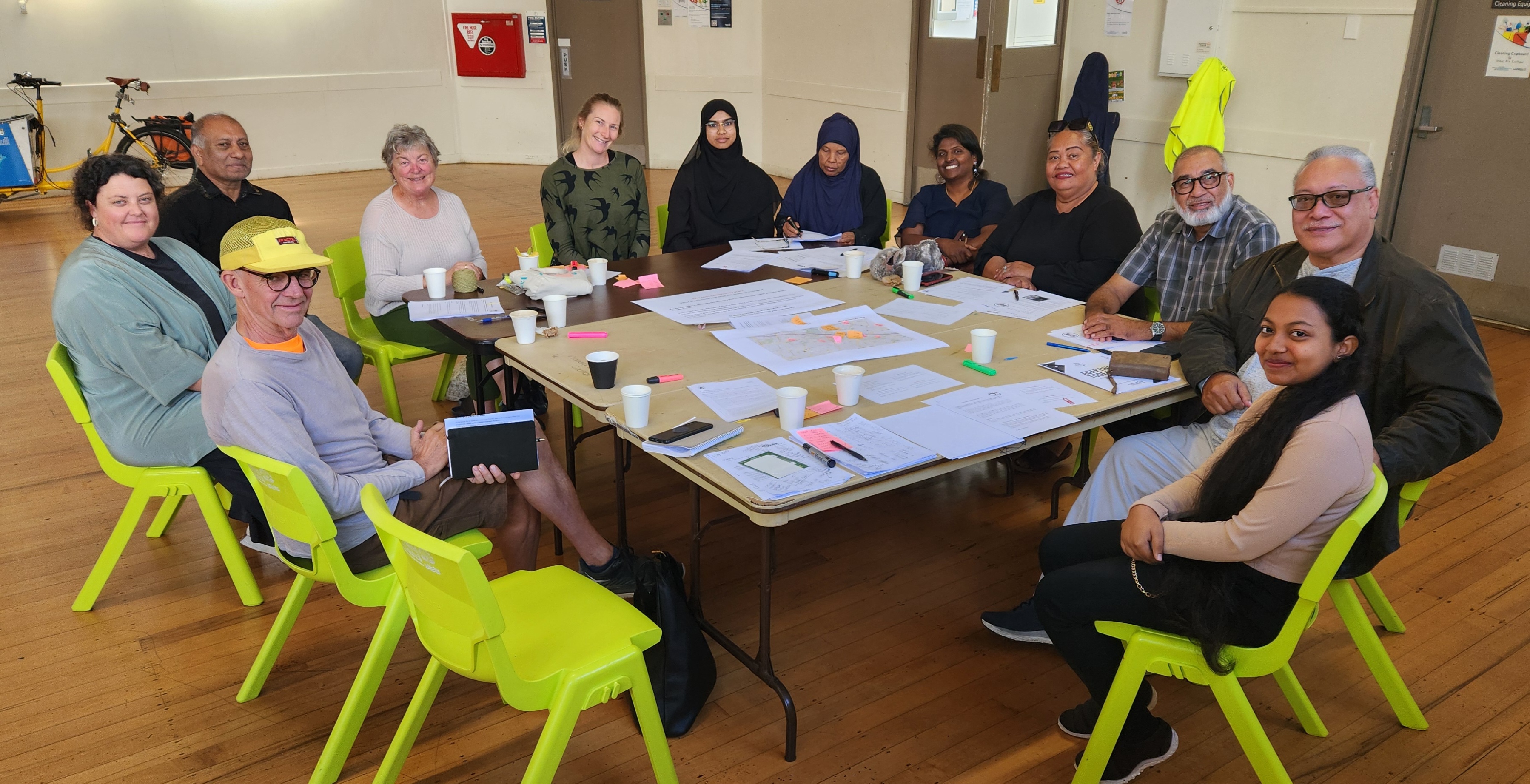
Local recovery planning is about supporting communities to work together to identify their own recovery needs and make plans to actively address these needs at the street, neighbourhood or community level. At its simplest, it’s about bringing communities together to think about what still needs to happen in their area to feel recovered and then identifying actions they can take themselves to make this happen.
To ensure the community can shape recovery plans, a Wesley and Mt Roskill Leadership Rōpū (group) was formed with the support of the Tāmaki Makaurau Recovery Office. The group is made up of locals from different walks of life including ethnic and religious communities, homeowners, private renters and Kainga Ora tenants.
The Wesley and Roskill Community Led Recovery Action Plan will address both immediate needs and focus on what these neighbourhoods need to thrive and feel genuinely recovered.
If you’d like to participate in shaping the plan, find out about events or have your say, email Heather at thecommunitycollectivenz@gmail.com.
Understanding Auckland's flood maps
In Auckland, we’ve seen how natural hazards like flooding, coastal erosion and landslides can impact people, homes and businesses.
We’re also seeing more Aucklanders interested in knowing about their flood risk including when they’re looking to purchase property or move into a new rental property. This includes checking the flood hazard maps on Auckland Council’s Flood Viewer or Geomaps beforehand, or by purchasing a Land Information Memorandum (LIM) report.
Visit our flood maps explainer for some useful information on how and why we publish these maps, and what they mean.
Managing development in hazard areas
Auckland Council wants to allow more housing choice - but in the right places. Since 2023 floods Auckland Council has been advocating to the Government for the power to be able to strengthen planning rules even further
Stronger planning rules for Auckland hazard areas came into force on 3 November 2025. These are key elements of Plan Change 120 which seek to restrict building in high hazard areas and strengthen the standards that must be met by developers when applying to build in these areas.
There are maps showing zones that determine what kind of development will be allowed where – to ensure building happens in the right places. However, regardless of what planning zone a property is in, strict consenting rules will apply for any development being proposed in a hazard area. They will have to show the risk can be mitigated and not impact neighbours etc.
These rules come in as soon as possible so developers don't rush to get consents approved ahead of the rules changing. In the meantime, council is taking feedback on the entire plan change with an official public submission process.
For more information, visit the Plan Change 120 page on the council's website.
Preparing your home and family
There is a lot of information available about flood risk in communities and at homes, with a key resource being the Auckland Council Flood Viewer where you can search to find Auckland addresses. Connected to this, there is some fantastic information to help you reduce the flood risk at your home prepared. Visit Auckland Council’s website for English and translated guides on how to reduce flood risks on your property.
Reporting flooding, dumping and stormwater blockage issues to 09 301 01 01 will ensure the council can address issues as soon as possible.
Emergency readiness
An Emergency Readiness Plan is in place for the Puketāpapa Local Board area, accounting for its unique local attributes and communities. Visit the Auckland Emergency Management local readiness page where you can also find a summary sheet of important emergency information for you and your whanau, including locations of local emergency evacuation centres.
Local groups are also stepping up, playing a key role in emergency planning and preparing to lead community hubs and local response efforts when needed. You can find a list of these in the summary sheet.