
Auckland’s coastal monitoring data is now publicly viewable on Auckland Council’s newly launched Coastal Monitoring Portal. This means that Aucklanders can now access data like sand levels, coastal camera imagery, and wave and water levels at key Auckland beaches.
Cr Richard Hills, Chair of the Policy and Planning Committee says that it’s great to see the council sharing its data in this way.
“Council staff collect so much useful data from Auckland’s beaches – like sand levels before and after storms as well as camera imagery and wave conditions. The data is used to inform a range of research as well as allow our teams to better understand the current state of and the impact of climate change on our coastline. Now, volunteers, community groups, students, researchers and general members of the public who are interested can also access this data,” says Cr Hills.
Auckland Council’s Environmental Evaluation and Monitoring Unit collects a wide range of environmental data to inform the council’s work. This project builds on data already available on the Environmental Data Portal, allowing important coastal monitoring data to be shared publicly.
Understanding our coast better
Long-term coastal monitoring datasets are valuable resources used to deepen our understanding of the state of Auckland’s beaches, as well as explore the drivers of coastal change.
“Data is collected from a wide range of Auckland’s beaches, and we continue to look at growing this list and expanding our scope of monitoring sites across the entirety of Tāmaki Makaurau,” says Paul Klinac, General Manager of Engineering, Assets and Technical Advisory.
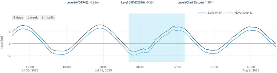
This is achieved using a range of tools. Real-time kinematic (or RTK) GPS and drone survey data is collected to monitor changes in sand levels and the shape of the beach over time. Wave buoys and tidal gauges are used to record the wave conditions and water levels that drive changes at our beaches.
Coastal monitoring cameras are used to provide real-time imagery of selected Auckland beaches. We currently have eight cameras installed around Auckland with one more to be installed at Onetangi in the next few months.
The coastal monitoring cameras provide a comprehensive view of beach response to storms and other dynamic events over time – the newest cameras have been installed at Long Bay, Te Arai and Mairangi Bay.
Additionally, numerical models provide a 7-day marine forecast of winds, waves, currents, and water levels for the Auckland region.
A well as monitoring storm events, and seasonal to long-term changes at our beaches our monitoring equipment can also pick up extreme events such as the tsunami that reached our shores last week. The Waiheke Island tidal gauge that Aucklanders can access through our Coastal Monitoring Portal recorded slightly higher levels as it entered our waters.
How will this be used?
Aucklanders are encouraged to explore the portal and see how climate change has had an impact on our beaches, such as from an increasing sea level and changes in the frequency and magnitude of storm conditions.
Within the council, the data will help inform and implement Shoreline Adaptation Plans and support informed coastal management decisions. Monitoring beach response and recovery to storm events also provides crucial data to improve emergency response plans for Tāmaki Makaurau.
Additionally, coastal monitoring data is available for research purposes and will be used for academic and scientific research that contributes to the understanding and preservation of our coastal environments.
“We encourage anyone who loves and uses the coast – whether you’re a surfer, fisherman, ocean swimmer, or a beach goer to access Auckland’s Coastal Monitoring Portal to check the current and likely future conditions at your local beach and learn more about changes along our coastlines,” says Paul Klinac.
Remember, you can visit Safeswim for information to make informed decisions on when and where to swim. Safeswim provides access to real-time information on water quality, swimming conditions, and safety hazards for popular swimming locations around the region.
How can I find out more?
You can check out our ‘About’ and ‘FAQ’ page to find out more about Auckland’s Coastal Monitoring Programme or here to check out the other environmental data collected by Auckland’s Environmental Evaluation and Monitoring Unit.
Look out for our Coastal Processes State and Trends Report to be published in September this year, for more context and detail on coastal change at key Auckland beaches. Keep an eye on: knowledgeauckland.co.nz
You can also reach out to the team with your questions or to request data: coastalmonitoring@aucklandcouncil.govt.nz.