

Auckland Council Principal Transport Advisor George Weeks, former Urban Designer at Transport for London, shares his thoughts on the benefits the Auckland region will experience when the City Rail Link (CRL) is operational in 2026.
George explains how this major infrastructure investment will deliver a significant return on the council’s 50% stake in the project, when it doubles the number of people experiencing a public transport journey time of 30 minutes or less into the city centre from opening day in 2026.¹
He brings his urban design experience to the conversation and gives examples of what makes cities efficient, easy to get around and pleasant to spend time in. He supports the view that CRL will enable Auckland to become more connected, and then that supports a more liveable, productive, modern city, attracting top talent to live and work here.
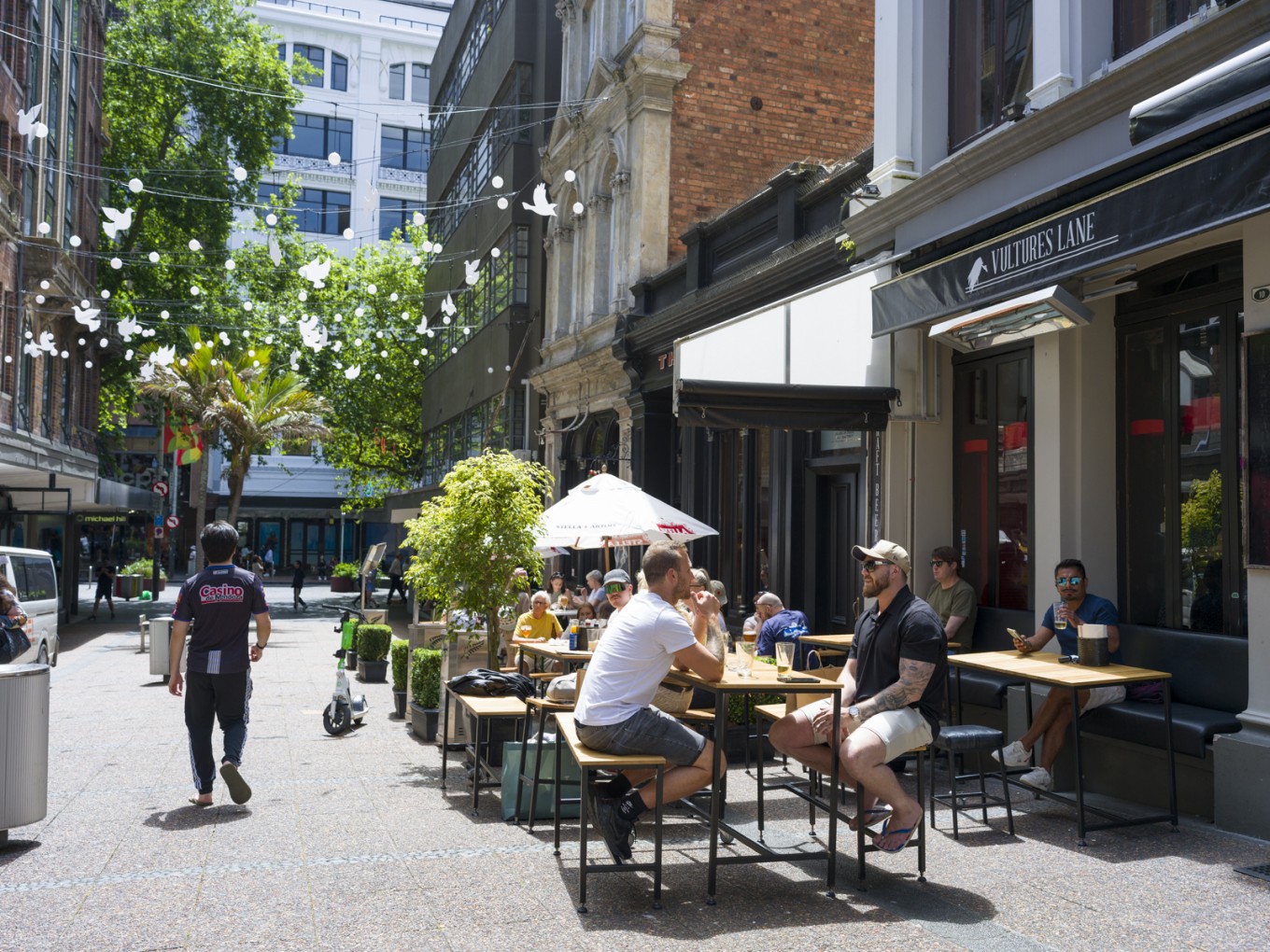
George says the city centre’s three CRL station neighbourhoods are already starting to shine. In the Waitematā Station neighbourhood which will be completed first - in February 2026 - he says: “You can already go to Quay Street without any agenda whatsoever and it bustles.”
And he gives a glowing report card to our bus system which he says is well placed to play a key role in an efficient integrated transit network.
This is part of an occasional Q&A series with urban and economic development leads within the Auckland Council group.

George Weeks, Auckland Council Principal Transport Advisor.
Our Q&A with George Weeks:
Q. What are the biggest measurable benefits of CRL for the region?
We'll have two new city centre stations in Auckland's densest, most productive area, which means 21,000 more residents, 17,200 more students and 37,000 jobs (these are current city centre residents / students and existing jobs) will now be within a 12-minute walk of Karanga-a-Hape and Te Waihorotiu Stations.²
We're going to get a big jump in connectivity. It means the city centre, which is already the densest residential and employment area in the country, is going to be accessible by more trains, connecting directly to more neighbourhoods.
It makes the best-connected part of Auckland even better-connected. We've built a short length of tunnel to make our whole system substantially more efficient.
By turning a terminus station – Waitematā Station - into a through station, we’ll be able to increase train frequencies into the city, and throughout Auckland, in the long term. So that's outstanding news. Frequency is the absolute key of public transport.
And regionally the benefits are enormous. For example, post-CRL if you're travelling from Henderson peak morning to midtown, you’ll save 24 minutes in travel time. It will become a direct route - no changes from train to bus, and no going around three sides of a square.
If more people can reach the centre, which is the biggest employment location in the region, then it makes more sense to develop, invest or open a business there. Public facing businesses thrive on footfall.
When the stations open, I think people will be surprised with what they see. They are very beautiful, immaculate, 21st century structures of the kind we’re just not used to.
Q. Why do cities need to make it easy to get around?
Cities that do well are the ones where it’s worth getting off the couch and going out of your front door – for as many reasons as possible.
CRL will be used for many types of journey in addition to commuting. I think only about 20% of journeys in Auckland are commutes. The rest are going to the shops, visiting friends, entertainment, hospitality. It’s our job to communicate this to the public.
London Underground in the 1920s realised people were mostly using the Tube for commuting. They realised that it made sense to promote its use throughout the day and evenings as well. Contemporary adverts promote using the Tube to visit the West End in the evenings and home again.
We can do the same here and now. After work or in the weekends, being able to go by rail directly into the city centre, not worrying about car parking, traffic, getting a taxi home after a show, is going to be a really big deal. And this is not just about people who live in the city centre. You're going to have direct trains to Karangahape Road from Pukekohe. This has never happened before.
People-prioritised urban spaces - Vulcan Lane - photo credit Gino Deneer.
Q. How is population growth measuring up against CRL business case forecasts?
Population growth in Auckland has exceeded what was assumed in the CRL business case. Up until Covid-19, rail travel grew faster than predicted, and our bus system has had a decade of improvements.
Darren Davis , who was formerly a Principal Transport Planner at Auckland Council, said: ‘Auckland has the best frequent transit network of anywhere in Australasia. The inner parts of Sydney have more frequent bus services but for metropolitan Sydney as a whole, Auckland’s bus network is still in the lead.
‘To give you a sense of the scale of the change, 10 years ago there were around 10 frequent bus routes. Auckland currently has 40 frequent bus routes and this number will have increased to 45 frequent bus routes by the end of next year; four-and-a-half times as many as from the bad old days of just a decade ago,’ Davis said.
Read more about this here: The frequentisation of Tāmaki Makaurau.
Q. What do you mean by the geometry of public transport?
Public transport enables many people to travel simultaneously. Cities work because they're able to bring many more people into the same space, and the only way you can do that geometrically is with public transport.
If you want to move more than 20,000 people per hour, you have to use rail. That's the only way to do it. And this is just geometry. Try filling a city with 20,000 cars per hour – similar to ten full Civic Carparks – and you’ll have complete gridlock.
There was once only one metro system in China – in Beijing. And now 47 cities in China have metros because they realised if you want cities to work at scale, you need to enable people to move around efficiently. It’s the same here in Auckland.
Q. How important are people-prioritised station neighbourhoods?
Vital. There is absolutely no point in investing $5.5bn in something like City Rail Link if the station surroundings are unwelcoming. Station streetscapes must prioritise pedestrians.
I'm interested in environmental psychology - the study of how people react to their surroundings. Major architecture practices like Foster + Partners employ environmental psychologists to distil the academic literature into design advice. Urban designers and architects can then use this advice to deliver buildings and places that are genuinely, empirically appealing.
The science of how people use space is fascinating. I can imagine a David Attenborough type narrative: ‘Here you can see the people sitting on walls and benches. They are in their spaces. This is the human habitat.’
Devonport is a good example of a human-scale habitat. It's very explorable. It's nice, even when the weather's bad. It's cosy in a way that other places in Auckland are not. Everything is walkable. It’s connected by ferries and buses.
In the regeneration of Auckland’s city centre and town centres, we are seeing the human-side taking a central position in design which is great to see. The station neighbourhoods are shaping up well.
Victoria Street West cycleway – part of Te Hā Noa linear park.
Q. What scorecard would you give the station neighbourhoods as they near completion?
Karanga-a-Hape Station neighbourhood is already New Zealand's most famous place to go for a good time. And doubling the number of people within a half-hour train journey from you is an extraordinary opportunity for anyone owning or opening a business there.
Karangahape Road was rebuilt with trees, wider footways, new cycleways, better lighting and streetscape enhancements in 2021. And now the same cross section has been continued down Pitt Street as far as the fire station. This, along with the Beresford Square rebuild and the new Mercury Lane shared space, will turn a previously linear neighbourhood into one that is cross-shaped, at its busiest, best-connected centre. This is best practice transport and urban planning.
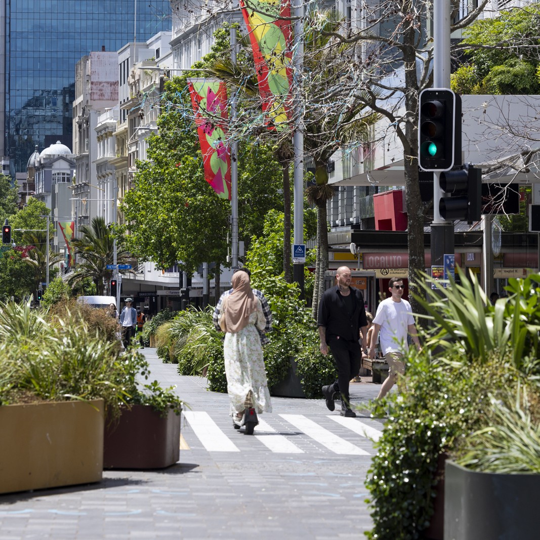
In the streets of midtown, more space has been provided for people walking. This is sensible in a place where most journeys are made on foot. Victoria Street now contains a linear park - Te Hā Noa. This was one of the best-supported parts of the 2012 and 2020 City Centre Masterplans and the idea is for it to continue all the way to Victoria Park.
Queen Street now has more space for people, with planting and a cycleway, at least for the first half of its length. With less through-traffic, it’s a much more pleasant space to be, and the street is easier to cross.
Wellesley Street will be the main bus interchange with City Rail Link. It is going to carry up to 140 buses per hour, so it is being rebuilt with a strengthened carriageway and much wider footways to let people move easily to and through the area.
And downtown’s terrific. I went to Waiheke Island a couple of weekends ago so cycled down to Quay Street to catch a ferry at 8:30am on Saturday. And it was humming. It was busy. I had to push my bike and it wasn't a festival or anything. It was just a regular sunny Saturday morning.
Te Komititanga is one of the best squares in Auckland. You come out of the station into this beautiful square. You're clearly somewhere exciting. You can go there without any agenda whatsoever and it bustles.
I think the point about creating reasons to get off the couch and go somewhere applies to all three station neighbourhoods in the city centre now.
People-prioritised urban spaces - Queen Street – photo credit Gino Deneer.
Q. Imagine you live in Papakura. How will moving around change when CRL is operational?
You will have a direct rail connection with two more stations in central Auckland. It will be more convenient as the trains will be more frequent. You will have interchange with buses to the North Shore close to Waitematā Station and bus access to the airport at Puhinui Station. In the other direction, you’ll have direct rail connection to Pukekohe, plus links to the new station precincts at Paerata and Drury, also opening in 2026, with new local bus connections.
Q. Imagine Henderson
With a 35-minute rail journey from Henderson to Aotea Square, operating late seven days a week (extra late on Friday and Saturday), you will have the freedom to come in and see Priscilla Queen of the Desert (or whatever’s showing in the city centre) by train.
Western line - New Lynn Station - photo credit Rachel Blundell.
Q. And North Shore
North Shore has got extraordinary connectivity with the Northern Busway already. People were extremely sceptical of the Northern Busway when it was built. But it comes back to this: people do what is easiest, and the busway has proven to be easy to use, quick, cheap, frequent, and it goes where you need to go.
Arriving in downtown on the NX1 or NX2, it’s a seamless trip. You cross the street and you're on your train. It has good interchange with local bus networks too. It’s known as an open busway system where buses use the busway and branch off. So it's a very efficient network.
Q. And Glen Innes
The trip from Glen Innes is already a fast trip because that section of Auckland’s rail system was built in the 1930s so it’s much flatter; it has no level crossings. It is a much more modern piece of line than the rest of the network. So as a result it is a fast service already. Travelling from Glen Innes to Eden Park to see the All Blacks, the Blues, T20 cricket or Guns ‘n’ Roses will become a single trip.
Q. And what are your own transport choices?
Like most people I use whatever is easiest. I think most people's transport choices are a combination of habits and ease.
For most journeys, by far the easiest way to get around is on my E-bike. You are congestion-proof, you are gradient-proof because you've got a motor, and you can go wherever you like. I will use ferries if I'm visiting friends in Devonport or going out to Beachlands because that's the best way to get there.
And Auckland's bus service is terrific as well. I think people underestimate how much better it has become in the past 10 years. It is outstandingly well connected – over $500m funding from the Climate Action Targeted Transport Rate (CATTR) has delivered 10 new bus routes and improvements to 67 existing routes. And if you're going on the North Shore busway, AT is running a year-long trial taking bicycles on the NX1, so you can combine the two if you want to.
I don't own a car at the moment. I used to, but when the head gasket failed I was too cheap to buy another. And I wasn't using it 99% of the time.
Footnotes 1 and 2:
Sources of the calculations:
- Current travel times: Auckland Transport GTFS services, modelled using Conveyal’s R5 routing engine for multimodal accessibility analysis - General Transit Feed Specification, and GitHub - conveyal/r5: Developed to power Conveyal's web-based interface for scenario planning and land-use/transport accessibility analysis, R5 is our routing engine for multimodal (transit/bike/walk/car) networks with a particular focus on public transit.
- Post‑CRL travel times: 2026 public transport services provided by the Auckland Forecasting Centre for the Benefits Realisation Plan.
- Land use: Auckland Council’s Auckland Growth Strategy land use forecasts for 2026, disaggregated to hexagon resolution 10 (AGS23v1.1, 2023) - Auckland growth scenario 2023 version 1.1 AGS23v1.1. Data - Knowledge Auckland.
- For reference, midtown was used as the central point when calculating travel times to city centre - a point in the vicinity of Aotea Square.
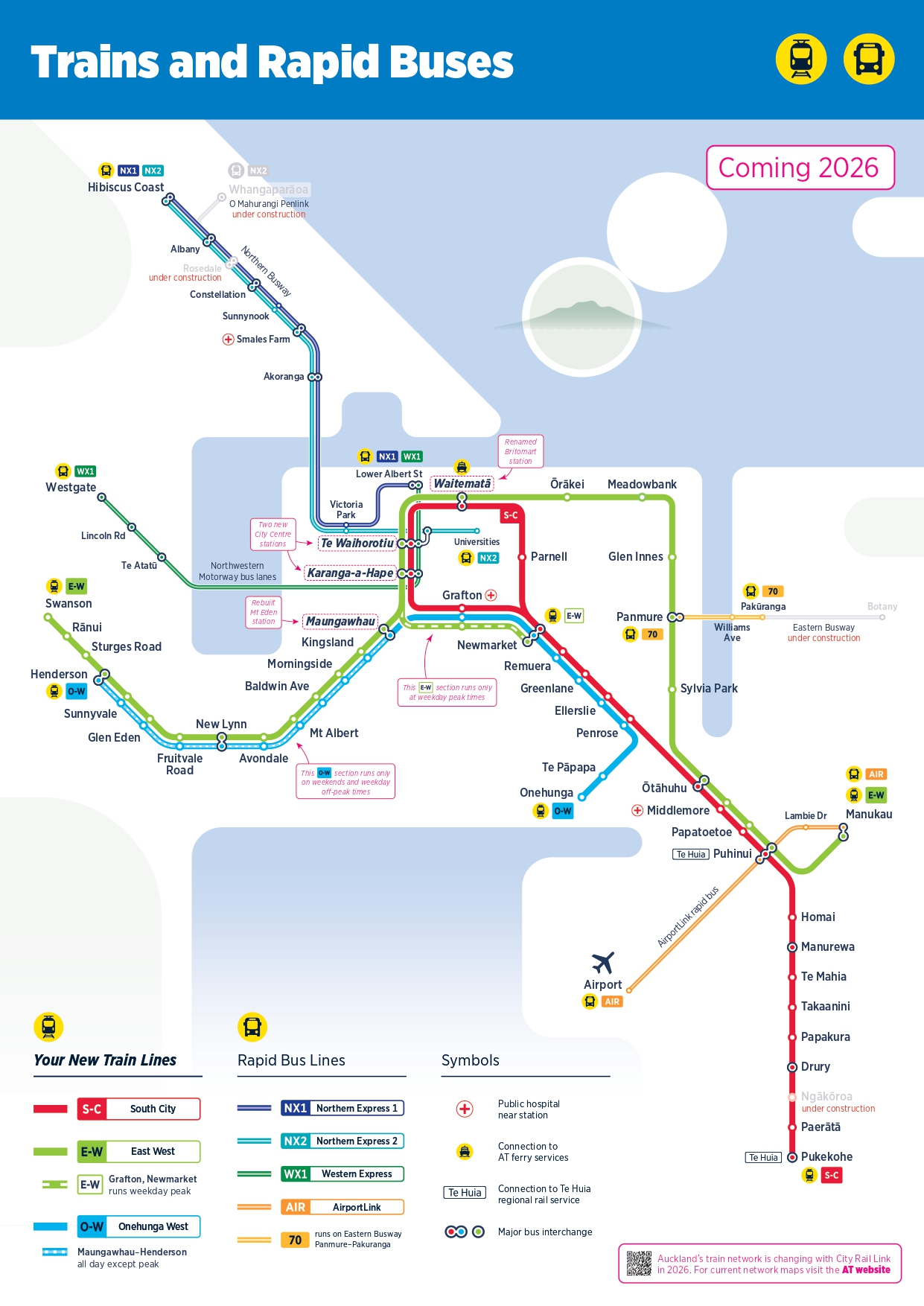
AT transit map - once CRL operational.