The Beachlands and East Shoreline Adaptation Plan has been endorsed by Franklin Local Board after widespread community consultation.
Analysis has shown most Beachlands and East shoreline areas can be managed over the next 100 years with limited to no active intervention.
Supported by Wairoa subdivision members, Board Deputy Chair Angela Fulljames and Malcolm Bell, the plan provides site-specific strategies outlining a preferred coastal management response for various sites over time.
Fulljames says implementing the plan will require strategies to be part of asset management plans for maintenance and renewal.
“Where strategies can be implemented through existing budgets, that should happen now. There are clearly areas that need attention, and this will help us advocate for funding where it is needed.
“When we require additional budget we will have to prioritise because plans being prepared in other Franklin areas need to be completed.”
The plans are being developed across Auckland to provide a long-term adaptation strategy for council-owned land and assets in response to coastal hazards, rising sea-levels and climate change.
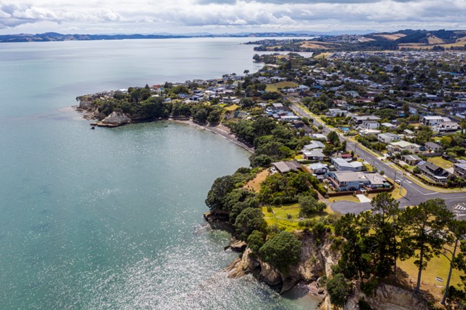
The Beachlands and East plan covers the area from Pine Harbour, Beachlands to Matingarahi at the Auckland regional border, including both Waharau and Whakatīwai Regional Parks to the south.
Bell says wide community engagement began last October and closed in February.
“The views of local iwi Ngāi Tai ki Tāmaki, Ngaati Whanaunga, Te Ākitai Waiohua and Ngāti Pāoa) were canvassed at a series of online hui to understand the cultural values of the coast.
“The Beachlands and East coast was divided into 31 sections and by aligning risk assessment results with iwi feedback and infrastructure and community objectives, adaptation strategies can be developed.”
The plan is here, and will be presented to Council’s Environment and Climate Change Committee this month for approval.
