With categorisation underway across Tāmaki Makaurau, many homeowners are waiting to receive a final category for their property.
As indicated by our recovery timelines, the risk assessment process takes several months to complete. We understand that waiting for a final category can be challenging but these assessments are complex and important, so they can’t be rushed.
To help you understand what goes on during a flood risk assessment, we’ve broken the process down into the following nine steps.
Watch the videos below to hear from flood assessor, Gina Nicholas, and Healthy Waters Head of Planning, Nick Vigar, as they explain the key steps in a flood risk assessment.
Please note that the process for flooding and geotechnical assessments is different. If you would like to find out more about the geotechnical process have a look at this article or access our geotechnical assessment guides in the document library.
Step one: Registration form
To begin the risk assessment process, a homeowner must fill in a flood and landslide registration form. Within the form you can submit photos/videos of the flooding that occurred during the Auckland Anniversary floods and/or Cyclone Gabrielle.
Step two: Initial screening
A flood assessor reviews the registration form and confirms the location and property owner(s)’s details are correct.
Step three: Detailed desktop assessment
A flood assessor analyses all the flood-related information available on the property. This includes any information council holds on the property, such as history of flooding, consents and/or placards, combined with data from flood modelling.
Watch the short video below to find out from a flood assessor what happens during a detailed desktop assessment.
Step four: Site visit
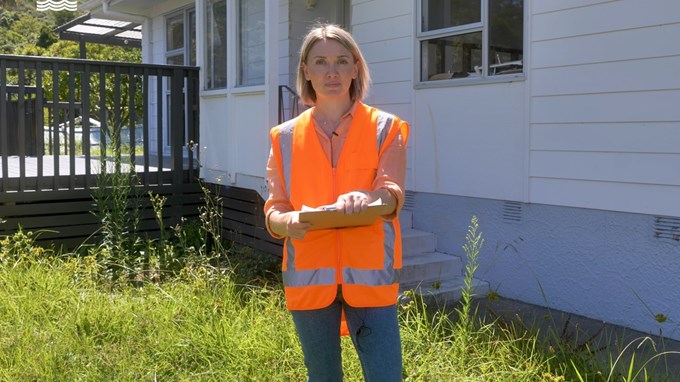
A flood assessor visits the property to gather evidence on how and why the property flooded, and to fill in any information missing from the desktop assessment.
Watch the short video below to find out from an assessor what they look for during a site visit.
Step five: Risk assessment (matrix)
The assessor then uses all the data from the desktop assessment and site visits to see where the property is on the flood risk matrix for both the observed and modelled flood events. From this they can understand whether there is an intolerable risk to life at the property.
Watch the video below to hear Nick Vigar (Healthy Waters Head of Planning) explain how the flood risk matrix is used to determine if there is an intolerable risk to life at a property.
Step six: Mitigation options
If it is determined that there is intolerable risk to life at the property, possible mitigation and remediation options are considered to assess if they are practical and feasible including:
-
External works e.g. landscaping
-
Building works e.g. raising the house
-
Community level works e.g. naturalising streams.
The outcome of this will determine the property’s category.
Watch the video above to hear Nick Vigar (Healthy Waters Head of Planning) explain more about the mitigation process.
Step seven: Category and report
The property’s category is decided, and a flooding risk assessment report is created.
Step eight: Quality Assurance
The report then goes through several layers of internal peer reviews for quality assurance.
Step nine: Final report and category
The final report and categorisation letter are sent to the homeowner. The homeowner then has three months to opt into the Category 3 buy-out scheme or the Category 2P grants scheme if they fall into one of these categories. They also have the opportunity to dispute their final category.
Glossary
|
Catchment |
A catchment describes an area of land where the stormwater runoff would flow and collect within a landscape. |
|
Flood plain |
Flood plains appear in low-lying areas and next to streams and rivers. They are areas predicted to be covered by flood water during heavy rain. As many historical streams have been piped, flood plains may appear in areas where you haven’t seen water before |
|
Flood-prone area |
Flood prone areas are low-lying areas where water can become trapped and collect during heavy rain, especially if the stormwater outlet reaches capacity. They can occur naturally or be created by changes to the land. |
|
Overland flow path |
An overland flow path is the route water will naturally take across the ground during heavy rain when the stormwater network is at capacity, or where there is no stormwater network. |
|
Proximity |
How close one object is to another. For example, how close a property is to a stream. |
|
Stormwater |
Stormwater is rain that has reached the ground. |
|
Stormwater infrastructure |
Stormwater infrastructure consists of assets used to manage rainfall run-off, such as pipes, catchment pits and culverts. |
|
Three waters industry |
Mentioned in the video with Gina. Three waters engineering encompasses stormwater, water supply and wastewater. |
|
Velocity |
Velocity combines the speed and direction of an object in motion. |
Watch more
All of our videos are available on the Recovery Office playlist on Youtube.


